
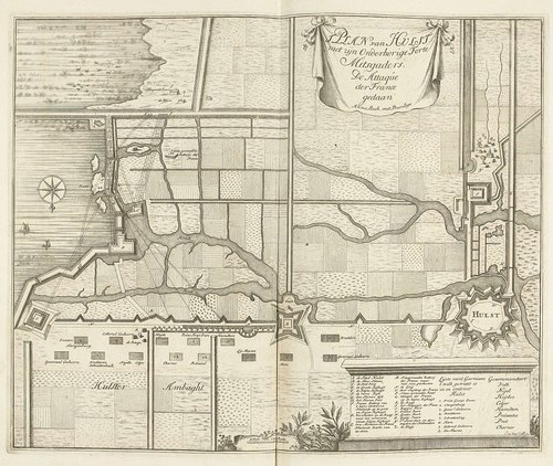
Kaart van de aanval van de Fransen op Hulst, 1702
1702
Medium
etching
Dimensions
380; 465
Rights
Public Domain
About this artwork
verzamelaarsmerk, verso, gestempeld: Lugt 2166
Art Historical Context
**Kaart van de aanval de Fransen op Hul, 1702** This intricate etching by Dutch artist Jan van Call I captures a pivotal moment in military history: the French assault the fortified town of Hulst in Zeeland, Netherlands, during the War of the Spanish Succession in1702. Measuring 380 × 465 mm, the map blends precise topography with dramatic battle scenes, illustrating troop movements, fortifications, and key positions. Van Call, a skilled engraver active in the 17th and early 18th centuries, specialized in such detailed topographic views, making this work a vivid historical document for contemporaries tracking the conflict between French forces under Louis XIV and the allied Dutch-English army. Etching, the medium here, allowed van Call to achieve fine, expressive lines through acid-etched copper plates, ideal for reproducing complex maps and vignettes with remarkable clarity. Produced in the year of the event, it served as timely propaganda and intelligence, reflecting the era's fascination with cartographic art amid Europe's grand-scale wars. The verso bears a collector's stamp (Lugt 2166), linking it to esteemed print connoisseur Frits Lugt and underscoring its enduring value in museum collections. Today, this piece invites visitors to explore how art mapped the chaos of war, offering a window into 18th-century strategy and Dutch resilience.